As the 2026 Atlantic hurricane season approaches, understanding the dynamics of hurricane tracking and forecasting can be your best defense. Are you equipped with the essential knowledge to stay safe and informed?
What You Will Learn
Key predictions suggest an increase in named storms compared to previous years, highlighting the need for preparedness.
Understanding spaghetti models can enhance your ability to assess storm track uncertainties and make informed decisions.
Monitoring the 2-7 Day Tropical Weather Outlook allows early identification of potential tropical threats.
Factors like ENSO and SSTs are crucial in predicting hurricane activity and intensity during the season.
Utilizing interactive maps and tracking apps can provide real-time updates and empower you to respond effectively during a hurricane.
Key Hurricane Season Indicators & Monitoring Tools
Understanding these critical factors and the tools used to track them is essential for hurricane preparedness.
Seasonal Outlooks & Intensity Indicators
TSR (Tropical Storm Risk) Group: Provides seasonal outlooks predicting notable activity, including increases in named storms compared to previous years.
ACE (Accumulated Cyclone Energy) Index: Key indicator of potential storm strength and duration, suggesting more intense storms based on higher values.
Key Monitoring Tools for Tracking
Spaghetti Models: Visualize various forecasting model outputs, showing possible paths and uncertainty.
2-7 Day Tropical Weather Outlook: Offers early insights into potential tropical system development.
Satellite Imagery: Provides real-time visuals for intensity, movement, and structural changes.
Factors Influencing Hurricane Development
ENSO (El Niño-Southern Oscillation) & SSTs (Sea Surface Temperatures): Affect activity; warmer SSTs often mean more active seasons.
Wind Shear & Saharan Dust Layer: Low wind shear aids formation; dust can suppress intensity.
Climate Change: Rising temperatures can increase storm intensity and alter patterns.
Interactive Forecasting & User Resources
Real-Time Maps & Trackers: Interactive tools for visualizing storm paths and impacts.
Hurricane Tracking Apps: Mobile alerts, forecasts, and live updates.
Real-Time Tracking: Current Hurricane Path and Forecast Insights for the Atlantic
As we dive into the 2026 Atlantic hurricane season, it's vital to stay informed about the latest hurricane paths and forecasts. At Hurricane News Today, we are committed to delivering real-time updates and comprehensive insights to help you navigate these stormy waters. So, what can we expect this season? Let’s explore the intricacies of hurricane tracking and forecasting together!
Overview of the 2026 Atlantic Hurricane Season
This year’s Atlantic hurricane season promises to be an interesting one. With advancements in technology and understanding, forecasts are becoming more precise. Understanding hurricane forecasts is crucial for preparedness and timely responses. We’ll break down the essential elements of forecast predictions to ensure you’re equipped with the knowledge to stay safe.
Understanding the Hurricane Forecasts for Named Storms
Hurricane forecasts are categorized into named storms, which allows individuals to easily track specific systems. The National Hurricane Center (NHC) plays a vital role in these forecasts, providing updates based on meteorological data. Here’s what you need to know about storm naming:
Storms are assigned names for easier communication and tracking.
Naming helps in issuing warnings and alerts.
Each season has a predetermined list of names.
Being aware of named storms can significantly improve your response during the hurricane season. It allows for clearer communication and focused monitoring.
Key Predictions: TSR’s Seasonal Outlook and ACE Index
The Tropical Storm Risk (TSR) group provides seasonal outlooks that are invaluable for tracking hurricane activity. Their predictions for this season suggest notable activity. The Accumulated Cyclone Energy (ACE) Index is another key indicator that reflects the potential strength and duration of storms. Key takeaways include:
Predicted increases in named storms compared to previous years.
Potential for more intense storms based on ACE values.
Enhanced monitoring of specific regions, especially the Gulf and the Caribbean.
These metrics help us stay ahead of the storm, making it essential to keep a close eye on the forecasts provided by trusted sources.
Monitoring Tools for Hurricane Tracking
To stay informed, utilizing effective monitoring tools is essential. At Hurricane News Today, we leverage various tools to provide real-time updates and accurate forecasts. Let’s dive into some key tools that make hurricane tracking easier!
The Importance of Spaghetti Models and How They Work
Spaghetti models are crucial in visualizing the paths that hurricanes may take. They display various forecasting model outputs, helping to assess uncertainty and predict possible storm tracks. Here’s why these models are so important:
They provide a range of possible paths, giving a comprehensive overview of potential outcomes.
Understanding spread in models can help gauge uncertainty.
They assist in making informed decisions about evacuations and preparations.
By analyzing spaghetti models, we can better prepare for the varying possibilities that hurricanes may present.
Utilizing the 2-7 Day Tropical Weather Outlook for Accurate Forecasting
The 2-7 Day Tropical Weather Outlook is another essential tool for monitoring hurricanes. This forecast offers insights into tropical systems that may develop within the next week. Key advantages include:
Identifying potential threats early on.
Providing timely updates on storm development.
Helping communities prepare in advance of possible storms.
Keeping an eye on this outlook allows us to stay one step ahead during hurricane season.
Leveraging Satellite Imagery for Enhanced Storm Tracking
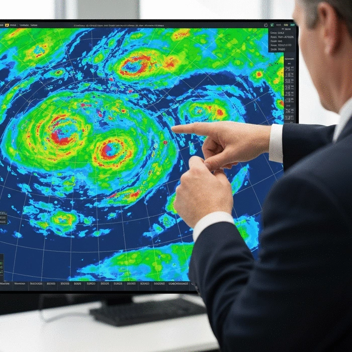
Satellite imagery is a game-changer for storm tracking. It provides real-time visuals of storm systems, helping meteorologists and the public understand their intensity and movement. Consider these features:
High-resolution images show current storm conditions.
Continuous monitoring helps in tracking changes in storm behavior.
Images can reveal critical information about storm structure and surrounding weather.
By leveraging satellite imagery, we empower our community with visual insights that enhance understanding and preparedness.
Seasonal Influences: Factors Affecting Hurricane Development
As we prepare for the season, it’s important to understand the factors that influence hurricane development. Several climatic elements play a role, and being aware of them can significantly impact our preparedness. Let’s look at these key factors!
ENSO and SSTs: How Climate Conditions Shape the Season
The El Niño-Southern Oscillation (ENSO) and Sea Surface Temperatures (SSTs) are critical factors that influence hurricane activity. Here’s how they affect storms:
ENSO phases can either enhance or suppress hurricane activity.
Warmer SSTs generally lead to more active hurricane seasons.
Monitoring these conditions helps predict future hurricane activity.
Understanding these climate conditions provides insights into what we can expect as the season unfolds.
Understanding the Role of Wind Shear and Saharan Dust Layer
Wind shear can inhibit hurricane development, while the Saharan dust layer can impact storm intensity. Here’s a closer look:
Low wind shear is conducive to hurricane formation.
Saharan dust can suppress storm development and intensity.
Monitoring these factors helps refine our forecasts.
Being aware of these elements can help us interpret forecasts more accurately.
Climate Change Effects on Hurricanes: What You Need to Know
Climate change continues to influence hurricane behavior. Increased ocean temperatures and changing weather patterns can lead to stronger storms. Key points to consider include:
Rising temperatures can increase storm intensity.
Changing patterns may affect where and when hurricanes form.
Staying informed about these changes is crucial for preparedness.
At Hurricane News Today, we are dedicated to providing the latest insights on these evolving challenges!
Interactive Forecasting: Tools and Resources for Users
Our mission at Hurricane News Today is to empower you with the tools and resources you need to stay informed. Our interactive forecasting tools are designed for user engagement and accuracy. Let’s explore these resources!
Embedding Real-Time Maps and Trackers for Enhanced User Experience
Real-time maps and trackers provide an interactive way to monitor hurricanes as they develop. These tools allow you to visualize storm paths and impacts. Here’s what they offer:
Interactive maps show current storm locations and paths.
Users can customize views based on their interests.
Real-time data helps in planning and response efforts.
With these tools, you can stay engaged and informed throughout the hurricane season.
How to Interpret Genesis Probabilities and Vorticity Maps
Understanding genesis probabilities and vorticity maps enhances your forecasting skills. These tools predict the likelihood of storm formation and measure rotation. Here are their key features:
Genesis probabilities indicate the chance of development within a specific area.
Vorticity maps show rotation, which is critical for storm formation.
Learning to interpret these maps can boost your forecasting confidence.
At Hurricane News Today, we believe that knowledge is power when it comes to hurricane preparedness!
Exploring Hurricane Tracking Apps for Immediate Updates
Mobile apps are a fantastic way to get immediate updates about hurricanes. They provide alerts, forecasts, and real-time information right at your fingertips. Here’s what to look for in a hurricane tracking app:
Alerts for your specific area based on current conditions.
User-friendly interfaces for easy navigation.
Access to live updates and radar images.
By utilizing these apps, you can stay connected and informed no matter where you are!
Historical Comparisons: Learning from Past Seasons
Understanding past hurricane seasons helps us prepare for future storms. By analyzing trends, we can gain insights into what might happen this year. Let’s review some historical comparisons!
Reviewing the 2025 Season: Actuals vs. Predictions
Looking back at the 2025 hurricane season, we can compare actual events with predictions. This analysis reveals:
The accuracy of seasonal forecasts and their implications.
Regions that experienced unexpected activity.
Lessons learned for improving future predictions, including insights from the 2024 verification report.
These comparisons help enhance our forecasting capabilities and community preparedness.
Identifying Regional Hotspots: Gulf, Bahamas, and Panhandle Risks
Every region has specific risks during hurricane season. Analyzing hotspots can help communities focus their preparedness efforts. Key areas to monitor include:
The Gulf Coast, known for its vulnerability to storms.
The Bahamas, often impacted by storm tracks.
The Florida Panhandle, which can experience intense storms.
Identifying these hotspots allows us to tailor our alerts and resources effectively.
Analyzing Historical Hurricane Data: Trends and Implications
By reviewing historical hurricane data, we can spot trends and make informed predictions. Considerations include:
Changes in storm frequency and intensity over the years.
Impacts of climate change on storm patterns.
The importance of preparedness based on historical impacts.
At Hurricane News Today, we’re committed to collaborating with our community to improve hurricane readiness!
Pro Tip
Did you know that utilizing local community resources can significantly enhance your hurricane preparedness? Connect with local emergency management agencies and participate in community drills. This not only keeps you informed but also builds a network of support during challenging times.
Preparing for Hurricane Season: Essential Tips and Resources
As we gear up for another hurricane season, it's crucial to be prepared! I often hear from people about their concerns regarding hurricanes, and it's understandable. To help you navigate this challenging time, I've compiled a list of essential tips and resources to ensure you and your loved ones are ready for anything Mother Nature throws our way.
One of the most important things you can do is stay informed. Keeping abreast of the latest updates and forecasts can make all the difference in your safety. Let's dive into some common questions about hurricane preparedness!
Addressing User Concerns: Common Questions About Hurricane Preparedness
How to Stay Updated on Current Hurricane Tracks and Forecasts
Staying updated is vital, especially during hurricane season! Here are some reliable ways to keep track of current hurricane activities:
Sign up for alerts from Hurricane News Today for real-time updates.
Follow local weather stations or the National Hurricane Center on social media.
Use dedicated weather apps that provide push notifications on storm developments.
By using these resources, you'll be well-equipped to make informed decisions during a storm.
Understanding Risks: What Should Residents in Affected Areas Do?
If you live in a hurricane-prone area, knowing the risks is crucial. Here are some steps to take:
Identify your evacuation route and make a plan with your family.
Prepare a hurricane kit that includes food, water, and first-aid supplies.
Secure important documents in a waterproof container.
Understanding the risks ensures you can act quickly when necessary. Remember, preparation is your best defense!
Understanding Hurricane Watches and Warnings: What They Mean for You
Hurricane watches and warnings can be confusing, but they are essential alerts. Here's what they mean:
Hurricane Watch: Conditions are possible within the next 48 hours.
Hurricane Warning: Conditions are expected within the next 36 hours.
When you receive these alerts, it’s time to take action! Make sure your plans are set and that you’re ready to move if needed.
Preparing for Storm Surge and Flood Risk in Coastal Areas
Storm surge is one of the most dangerous aspects of a hurricane. To prepare for potential flooding:
Know your elevation and how it affects flood risk.
Have an emergency plan that includes evacuation routes away from low-lying areas.
Consider flood insurance, especially if you live in a flood-prone zone.
Don't underestimate the power of water—being prepared can save lives!
FAQs about Hurricane Tracking and Preparedness
Here are some frequently asked questions to help you better understand hurricane tracking and how to prepare for the season:
Q: What are spaghetti models and why are they important?
A: Spaghetti models are visualizations of various forecasting model outputs that show possible hurricane paths. They are important because they help assess the uncertainty in storm tracks and assist in making informed decisions about preparations and evacuations.
Q: How does the 2-7 Day Tropical Weather Outlook help in hurricane preparedness?
A: The 2-7 Day Tropical Weather Outlook provides early insights into potential tropical system development. This allows for early identification of threats, timely updates on storm development, and helps communities prepare in advance of possible storms.
Q: What role do ENSO and Sea Surface Temperatures (SSTs) play in hurricane activity?
A: ENSO (El Niño-Southern Oscillation) phases and Sea Surface Temperatures (SSTs) are critical factors. ENSO can either enhance or suppress hurricane activity, while warmer SSTs generally lead to more active hurricane seasons. Monitoring these conditions helps predict future hurricane activity.
Q: What is the difference between a Hurricane Watch and a Hurricane Warning?
A: A Hurricane Watch means that hurricane conditions are possible within the next 48 hours, signaling that you should begin preparations. A Hurricane Warning means that hurricane conditions are expected within the next 36 hours, indicating that it's time to take immediate action and finalize preparations.
Q: How can I stay updated on hurricane information in real time?
A: You can stay updated by signing up for alerts from reliable sources like Hurricane News Today, following local weather stations or the National Hurricane Center on social media, and using dedicated weather apps that provide push notifications and live updates.
Emergency Management and Community Preparedness
Establishing Evacuation Zones: A Key Component of Disaster Preparedness
Evacuation zones are designed to keep residents safe during a hurricane. Knowing your evacuation zone helps you plan effectively:
Stay informed about local announcements regarding evacuations.
Understand the zone designations in your area.
Share evacuation plans with your neighbors to foster community safety.
By working together, communities can enhance their overall resilience!
Building Community Resilience: Strategies for Local Preparedness Plans
Community preparedness is crucial for effective response during hurricanes. Here are some strategies you can advocate for:
Organize community meetings to discuss preparedness plans.
Encourage local businesses to develop emergency response strategies.
Collaborate with local government to enhance resources and training.
Building a network of preparedness ensures that everyone knows what to do when a storm approaches!
How FEMA and Local Weather Stations Support Hurricane Response
FEMA and local weather stations play crucial roles in coordinating response efforts. Here's how they assist:
Providing timely information and guidance on what to do before, during, and after a storm.
Offering resources for disaster recovery and assistance.
Conducting training programs to prepare communities for emergency responses.
Leveraging these resources can greatly enhance your preparedness efforts!
Conclusion: Staying Informed and Prepared for Atlantic Hurricanes
Recap of Key Forecast Insights and Tracking Tools Available
As we wrap up this discussion on hurricane preparedness, remember that being informed is your best ally. Utilize resources from Hurricane News Today to get real-time updates and forecasts to stay ahead of any storm!
Call to Action: Engage with Real-Time Tracking for 2026 Hurricane Season
Are you ready for the upcoming hurricane season? Join our community at Hurricane News Today for the latest updates and expert insights tailored just for you. Let's work together to stay safe and prepared!
Recap of Key Points
Here is a quick recap of the important points discussed in the article:
Stay informed with real-time updates and forecasts to effectively prepare for the hurricane season.
Utilize named storm tracking for clearer communication and focus during emergencies.
Monitor key predictions from the Tropical Storm Risk (TSR) group and the Accumulated Cyclone Energy (ACE) Index to gauge hurricane activity.
Leverage monitoring tools such as spaghetti models, 2-7 Day Tropical Weather Outlooks, and satellite imagery for accurate storm tracking.
Understand climatic factors like ENSO and SSTs, as well as the influence of wind shear and Saharan dust on hurricane development.
Prepare an emergency kit, establish evacuation plans, and stay updated on hurricane watches and warnings.
Engage with community preparedness strategies and utilize resources from FEMA and local weather stations for effective response efforts.
Your go-to resource for live updates, breaking news, and comprehensive analysis of hurricanes worldwide. We help communities stay informed and prepared with our real-time alerts and in-depth safety resources.
Trusted by individuals and emergency responders, our mission is to provide timely and accurate hurricane information backed by seasoned meteorologists and cutting-edge storm tracking technology.