Comprehensive Data Collection
A combination of technologies provides a holistic view of storm development, enabling informed predictions.
Get Nolan Carter's live hurricane updates and expert forecasts delivered directly to your inbox.
Posted on: 2026-05-25
By: Nolan Carter
As hurricane season approaches, understanding the tools that track these powerful storms becomes essential for safety. With advancements in technology, we now have a range of resources at our fingertips that can empower us to stay informed and prepared. Are you ready to learn how to harness these tools effectively?
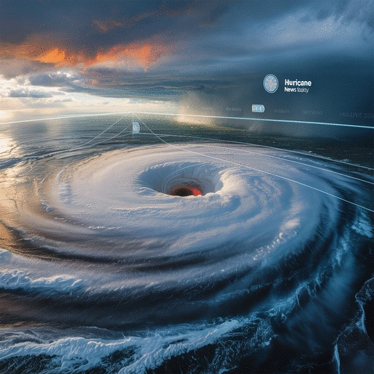
Modern hurricane forecasting relies on a suite of advanced technologies working in concert to provide comprehensive data. This visual highlights the primary tools used by meteorologists to predict hurricane paths and intensity.
A combination of technologies provides a holistic view of storm development, enabling informed predictions.
Bird's-eye view, cloud formations, moisture levels, storm structure, and path trajectory.
Real-time intensity, wind speed/direction, heavy rainfall, and storm rotation detection.
In-situ data: wind speed, temp, humidity, pressure readings directly from within the storm.
Continuous ocean conditions, real-time data from hard-to-reach areas, low-altitude insights.
Low-pressure systems for development, pressure drops indicate strengthening, high-pressure steering.
Hurricane tracking tools have become essential for anyone interested in staying safe during storm season. At Hurricane News Today, I believe that understanding how these tools function can empower communities. By leveraging technology, we can predict hurricane paths, monitor their intensity, and prepare effectively. Let's dive into some key components!
Each tool plays a vital role in synthesizing information that meteorologists use to make their forecasts. This understanding can make a significant difference when a storm approaches.
Satellite imagery is a cornerstone of modern hurricane forecasting. It provides a bird's-eye view of storm systems, allowing us to monitor cloud formations, moisture levels, and other critical factors. This data is invaluable for tracking hurricanes and predicting their paths with greater accuracy.
Not only does satellite data support storm path predictions, but it also helps us visualize the storm's structure. By analyzing the images, we can see how storms develop and intensify over time, giving us clues about their potential impact.
Satellite data assists in determining the exact trajectory of a hurricane. This information includes:
By integrating this data, meteorologists can create more accurate forecasts, helping communities prepare effectively. As a seasoned meteorologist, I’ve seen firsthand the difference timely information can make!
Doppler radar is another critical tool in tracking hurricanes, providing real-time data about the storm's intensity and movement. Unlike satellite imagery, which captures images at intervals, radar continuously monitors weather conditions. This enables us to detect changes in wind speed and direction almost instantaneously.
Using Doppler radar for accurate wind speed measurements is crucial. It allows for the identification of areas experiencing the strongest winds, which is vital information for anyone in the path of the storm.
Doppler radar helps meteorologists with several important features:
By understanding how Doppler radar operates, we can stay ahead of the storm and ensure that those at risk are adequately informed. Every piece of information counts when it comes to hurricane safety!
In addition to satellite imagery and Doppler radar, several other technologies are essential for predicting hurricane paths. These tools work together to create a comprehensive view of developing storms, allowing meteorologists to make informed predictions.
Each of these technologies contributes uniquely to our understanding of hurricanes, enhancing the accuracy of forecasts and our overall preparedness.
Hurricane Hunter aircraft provide an unparalleled perspective on storm systems. These specially equipped planes fly directly into hurricanes, gathering real-time data that isn’t available from ground-based tools. This information is crucial for developing accurate forecasts and understanding storm behavior.
Gathering in-situ data allows meteorologists to measure conditions directly inside the storm, which is essential for refining computer models and predictions.
The data collected by Hurricane Hunter aircraft includes:
This real-time data collection is a game changer. It provides insights that enhance our understanding of hurricane dynamics, ultimately leading to better forecasts!
Weather buoys and drones are revolutionizing how we collect data on hurricanes. Buoys positioned in the ocean gather information on wave heights, water temperatures, and atmospheric pressure, all of which are vital for tracking storm development.
Similarly, drones can access areas that are difficult for manned aircraft to reach. They can provide valuable data from low altitudes, enhancing our understanding of storm systems.
Both weather buoys and drones offer several key benefits:
By utilizing these technologies, we gain a more comprehensive understanding of hurricane conditions, which is essential for timely and accurate forecasting.
Atmospheric pressure plays a crucial role in hurricane formation and development. As a meteorologist, I’ve learned that low-pressure systems are integral to creating the conditions necessary for hurricanes to develop. The relationship between pressure and storms can’t be overstated!
Understanding how pressure variations influence storms is essential for predicting their intensity and potential impact on communities.
Several factors related to atmospheric pressure can affect hurricanes:
By analyzing these patterns, we can improve our forecasting abilities and help communities prepare for whatever the storm might bring. Knowledge is power, especially when it comes to hurricane safety!
As we explore the tools and technologies for tracking hurricanes, we’d love to hear from you! What has been your experience with hurricane tracking tools? Have you found any particular apps or resources that have been especially helpful? Share your thoughts below:
Here are some common questions about hurricane tracking tools and preparedness:
When a hurricane is on the horizon, having the right tools at your disposal is vital for effective preparation. At Hurricane News Today, we emphasize the importance of utilizing accurate tracking tools to keep you and your loved ones safe. Understanding how to monitor storms through reliable platforms can make all the difference when the winds start to howl.
Whether you’re at home or on the go, staying updated can help you make informed decisions. This section will cover the best practices for monitoring storms and how you can utilize tracking tools to ensure your safety during hurricane season!
To stay ahead of a hurricane, it's crucial to rely on trustworthy sources for storm updates. Here are some best practices to ensure you're always informed:
Using these tools can empower you to respond swiftly to any changes in the storm's path or intensity. The earlier you get the information, the better prepared you will be!
It’s essential to understand the tools that can provide you with the most accurate information. NOAA (National Oceanic and Atmospheric Administration) and NHC (National Hurricane Center) are your best bets for official updates. Additionally, there are numerous weather apps available that offer user-friendly interfaces and real-time data. Make sure to explore options like:
Each of these apps can send notifications directly to your device, keeping you informed wherever you are!
During hurricane season, knowing how to interpret alerts can save lives. Alerts range from watches to warnings, each indicating the severity of the storm. Here’s a quick breakdown:
Understanding these alerts helps you act quickly and effectively, ensuring your safety and that of your community.
Tracking tools play a crucial role in emergency preparedness. By staying informed through reliable sources, you can:
The goal is to ensure that when a hurricane strikes, you are ready to face it head-on with confidence and knowledge.
Storm surge is one of the most dangerous aspects of a hurricane, often leading to severe flooding. It’s crucial to integrate storm surge awareness into your preparedness plans. Utilizing tracking tools can help you understand where and when to expect these surges. You can also explore resources like the Historical Hurricane Tracks GIS Map Viewer to understand past storm impacts in your area. Here are some tips:
By being proactive and aware of storm surge risks, you can better protect your home and family from potential devastation.
In addition to tracking tools, staying informed through technology and community resources is essential. As a seasoned meteorologist, I can tell you that the combination of knowledge and technology provides the best defense against hurricanes.
Let’s explore some of the recommended apps, community efforts, and the significance of public safety alerts during hurricane season.
With a variety of hurricane tracking tools available, it’s important to choose those that suit your specific needs. Here are some categories to consider:
Finding the right tool for your situation can enhance your preparedness and ensure you’re always in the loop!
Consider your lifestyle and how often you need updates. For example, if you’re frequently on the go, a mobile app that sends push notifications is crucial. If you prefer detailed analysis, look for robust weather websites. Don’t hesitate to try out multiple options until you find the perfect fit!
Local authorities and community organizations play a significant role in hurricane preparedness. Resources to tap into include:
Engaging with these resources can bolster your readiness and strengthen community ties during hurricane season.
Local authorities often provide vital information and assistance during a hurricane. FEMA (Federal Emergency Management Agency) offers essential resources for disaster preparedness, recovery, and relief. By staying informed about their guidelines, you can ensure that you’re following the best practices for safety during a storm.
Public safety alerts are your lifelines during hurricane season. These alerts provide critical information about evacuation orders, shelter openings, and emergency resources. Here’s why they are so important:
Remember, staying connected to official communication channels is key to navigating the unpredictability of hurricanes.
Accurate alerts can make the difference between safety and disaster. By paying attention to these communications and acting quickly, you increase your chances of weathering the storm safely. Let’s all commit to staying informed and prepared as we face the realities of hurricane season together!
Here is a quick recap of the important points discussed in the article: