Key Takeaways for Interactive Tracking
- • Immediate access to real-time data
- • Enhanced understanding of hurricane dynamics
- • Ability to stay ahead of storm developments
- • Improved emergency preparedness strategies
Get Nolan Carter's live hurricane updates and expert forecasts delivered directly to your inbox.
Posted on: 2026-03-25
By: Nolan Carter
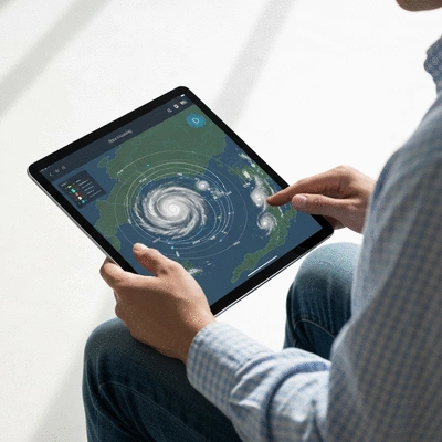
As hurricane season approaches, understanding the tools at your disposal can make all the difference. Imagine being equipped with real-time information that empowers you to make safety decisions for yourself and your family. Interactive hurricane tracking maps are vital resources that do just that—offering clarity amidst the chaos of approaching storms.
Understanding the features and reliability of hurricane tracking tools is essential for effective preparedness. Below is a comparison of leading apps and key takeaways for engagement.
| App Name | Real-Time Alerts | User Interface | Forecast Analysis | Additional Resources |
|---|---|---|---|---|
| NOAA Weather App | Yes | Simple | Detailed | Safety Tips |
| Weather.com | Yes | User-Friendly | Moderate | Interactive Maps |
| AccuWeather | Yes | Sleek | In-depth | Storm Tracking |
As we gear up for hurricane season, it's essential to understand the tools available to us. Interactive hurricane tracking maps are invaluable resources that allow us to visualize and monitor storm movements in real-time. By leveraging these maps, we can make informed decisions that enhance our safety and preparedness. Let's dive into what these maps are and why they are crucial for anyone living in hurricane-prone areas.
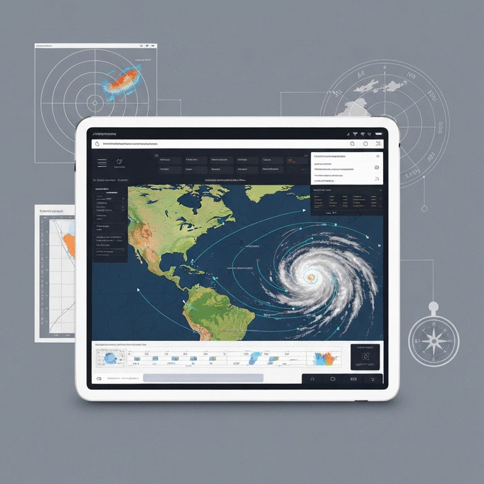
Interactive hurricane tracking maps are dynamic tools designed to display the current position and projected paths of tropical storms and hurricanes. These maps provide real-time data, allowing users to see storm developments as they happen. With features like zooming and panning, users can focus on specific areas of interest, ensuring they stay informed about storms that may impact their communities.
At Hurricane News Today, we strive to present these maps clearly and accessibly. Understanding how to read them correctly is the first step in developing a solid hurricane preparedness plan.
Reading hurricane tracking maps effectively can make a significant difference in safety during a storm event. These maps provide critical information that can help you decide when to evacuate or prepare your home. Ignoring the details—such as projected wind speeds or potential storm surges—can lead to dangerous situations.
In my experience as a meteorologist, I can't stress enough the importance of these maps. They empower communities by providing essential data needed to stay safe and informed. Now, let's explore how to effectively use these interactive maps to your advantage!
Now that we have a solid understanding of what interactive hurricane tracking maps are and their importance, let’s discuss how to use them effectively. Whether you’re a seasoned storm watcher or a beginner just starting, knowing the right steps to access and interpret these maps is vital.
Accessing interactive hurricane maps can be straightforward if you know where to look. Follow this simple guide to get started:
By following these steps, you can ensure that you always have the latest data at your fingertips. Trust me; being proactive about this can save lives!
When it comes to tracking hurricanes, reliable sources are key. The National Oceanic and Atmospheric Administration (NOAA) offers some of the most accurate and up-to-date information. Their interactive maps are designed to provide clear insights into storm trajectories and potential impacts.
Utilizing these trusted sources ensures that you are not only receiving accurate information but also critical safety advisories.
There are plenty of free tools available for tracking hurricanes. Some of my favorites include:
Using these tools can make tracking hurricanes more engaging and informative. Plus, they offer unique features that can enhance your understanding of storm behaviors and impacts!
Popular weather services like AccuWeather and Weather.com also provide interactive tracking maps. These platforms often include additional information such as:
While these services may not be as specialized as NOAA, they can be excellent supplementary resources. By combining insights from multiple sources, you can enhance your preparedness efforts—making informed choices even easier.
Interactive hurricane tracking maps aren't just for adults; they can be a fun learning tool for kids and beginners too! Here are some engaging ways to get started:
Printable tracking charts can help kids visualize storm paths and understand hurricane data better. You can create a simple chart template with:
This hands-on activity not only teaches kids about hurricanes but also makes learning about weather patterns interactive and fun!
Engaging kids in STEM activities using NOAA and HURDAT data can enhance their understanding of meteorology. Consider organizing a project where they:
These activities stimulate critical thinking and help foster a deeper appreciation for the science behind hurricanes. It’s a fantastic way to blend fun and education!
As you explore interactive hurricane tracking maps, consider setting up real-time alerts on your preferred weather apps. This proactive measure ensures that you receive timely updates directly to your device, allowing you to react quickly to any changes in storm paths or intensities. Stay ahead of the storm and keep your loved ones safe!
When it comes to interactive hurricane tracking, the benefits are crystal clear. These maps not only provide live updates but also help you understand the storm's path, intensity, and potential impact on your area. By utilizing these tools, you can make informed decisions to protect yourself and your loved ones.
By engaging with these resources, you empower yourself and your community to act wisely in the face of a storm. As the owner of Hurricane News Today, I know how crucial it is to stay informed during hurricane season, and these maps are essential tools for achieving that.
With so many options available, selecting the right hurricane tracking tools can feel overwhelming. It’s important to consider what features matter most to you. Here are some key questions to guide your decision:
By answering these questions, you can narrow down the best tracking tools that meet your unique needs. This way, you’ll be better prepared when storms threaten.
When evaluating hurricane tracking apps, it’s helpful to compare their features side-by-side. Here’s a quick overview of some leading options:
| App Name | Real-Time Alerts | User Interface | Forecast Analysis | Additional Resources |
|---|---|---|---|---|
| NOAA Weather App | Yes | Simple | Detailed | Safety Tips |
| Weather.com | Yes | User-Friendly | Moderate | Interactive Maps |
| AccuWeather | Yes | Sleek | In-depth | Storm Tracking |
By considering these factors, you’ll be able to find a tracking tool that suits your needs and keeps you prepared for any hurricane activity!
Now that you have the essential information on hurricane tracking, it’s time to dive deeper! Engaging with reliable resources is crucial for staying ahead of storms. You might want to explore interactive maps, subscribe to alerts, or follow trusted sources on social media.
For further learning, numerous platforms offer tutorials and comprehensive guides on using hurricane tracking tools effectively. Consider visiting:
These platforms can enhance your understanding and application of hurricane tracking, ensuring you remain prepared when it matters most.
As we continue to experience the impacts of climate change, it’s essential to stay informed about how these trends affect hurricane behavior. Engaging with resources on climate science can help you understand the broader context of storms.
Integrating real-time updates into your routine is vital. Sign up for alerts from trusted services and follow our platform, Hurricane News Today, for the latest information. Being proactive means you can act swiftly when storms arise, keeping yourself and your loved ones safe!
Here is a quick recap of the important points discussed in the article: